Posts

Mill Creek Canyon

Image
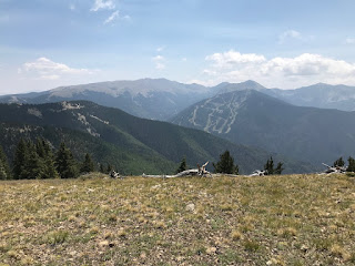
Gunnison NF. Near Gunnison, CO. 

Ohio Pass Overlook

Image
Gunnison NF. Near Gunnison, CO. Looking south and west to the West Elk Wilderness and Ohio Creek Valley. 

Beaver Ponds (again)

Image
West Elk Wilderness, Gunnison NF. Near Gunnison, CO. 

Quakey Mountain

Image
Gunnison NF. Near Sargents, CO. 

Mt Yale

Image
A 14er. From the Colorado Trail, Collegiate Peaks Wilderness, San Isabel NF. 

Iowa Gulch

Image
Near Leadville, CO. 

Mount Royal Trail

Image
Near Frisco, CO. 

Eagles Nest Wilderness

Image
Lily Pad Lake Trail.  Buffalo Mountain in background. Near Frisco, CO.  And the aspens are in prime colors!

Loveland Pass West

Image
Near Eisenhower Tunnel, CO. Good warm up hike!

New Mexico and Southern Colorado Summary

Image
Great trip and great weather in the Southwest US in August.  There was some rain, but the clouds that brought it were very beautiful!  Panoramas like the one below were common.  This is a view of Santa Fe Baldy (the very top obscured by clouds) and Lake Peak to the far right.  Short trip up the mountain from Santa Fe to the ski area parking lot and lots of hiking from there!  ~ 70 miles of hiking in 8 days.  Altogether, 1065 miles of driving.

Cerrillos Hills

Image
Between Santa Fe and Albuquerque, NM

Santa Fe National Forest

Image
Lake Peak, near Santa Fe, NM. 

Trampas Trail

Image
Into the Pecos Wilderness. Carson NF on the high road to Taos, NM.

Picuris Mountains

Image
Carson NF, near Taos, NM. 

Gavilan Canyon Trail

Image
From the valley to the ridge, this is an excellent trail!  Columbine-Hondo Wilderness Area (Carson NF) near Taos Ski Valley, NM.

Valle Vidal foothills...

Image
Carson NF,  near Costilla, NM.

Latir Lakes Trail

Image
Carson NF. Near Costilla, NM.

Sawmill Gulch Trail

Image
Rio Grande NF. Near Creede, CO.

Inspiration Point

Image
Hike right out of Creede. Up and over back to town, or another mile to the point. View from the Pinnacles.

South Fork Foothills

Image
Morning walk out back of the motel.  South Fork, CO.  Rio Grande River Valley.  

Treasure Mountain

Image
Wolf Creek Pass, Rio Grande NF. Near South Fork, CO.

Wolf Creek Pass

Image
Continental Divide Trail, Rio Grande NF. Near South Fork, CO.

Lookout Mountain

Image
View of Southern Rockies in Rio Grande Valley. Lookout Mtn. is in Del Norte, CO. 

Alamosa River Canyon

Image
From Rock Creek trail, Rio Grande NF. Near Monte Vista, CO.

South San Juan Wilderness

Image
Oh, what meadows!  Red Lake Trail, Rio Grande NF.  Plateau is ~ 11,000'.

St. Simons Island Beach

Image
Sunset, at low tide. 

Thacher State Park

Image
Helderberg Mountains, near Albany, NY. 490 miles driving in 9 days in Upstate New York!  This region is a national treasure.

Blue Ledges on Hudson

Image
Near Minerva, NY. The "ledges" refer to the cliffs on the other side of the river (out of view).

Rich Lake Paddle

Image
Near Newcomb, NY.

Owl’s Head Mountain

Image
From the fire tower. Near Long Lake, NY.