Posts

Central California Trip Summary

Image
Great trip to California!  Had to dodge power shutoffs due to wind and fire danger, but overall I was fine.  1200 miles driven in 9 days, plus 60 more miles on foot.  Perfect weather and a great time with my dear friend David!

Kaiser Peak

Image
Kaiser Wilderness. Sierra NF, near Huntington Lake, CA.

Kaiser Wilderness

Image
Potter Creek Pass. Looking out upon San Joaquin River watershed. Sierra NF. Near Shaver Lake, CA. 

Little Shuteye Peak Approach

Image
Sierra NF, near Oakhurst, CA. 

Emigrant Wilderness

Image
Beyond Burst Rock. Gianelli TH, Stanislaus NF. Yosemite to right in view.

Bald Mtn. Reprise

Image
And boy, am I glad I came back! Beautiful, calm, warm evening. Unsurpassed views of the Stanislaus and N Fork Tuolumne watersheds.  Stanislaus NF, near Pinecrest, CA.

Lyons Ridge

Image
Lyons Dam Trail. Stanislaus NF, near Sierra Village, CA.

St Mary’s Pass Trail

Image
Exploring rocks to left of trail.  Sonora Peak at ~ 11,500'. Stanislaus NF. Between Bridgeport and Pinecrest, CA. 

Sonora Pass

Image
Pass is 9650'. Hiking Pacific Crest Trail north. Stanislaus NF.  Between Bridgeport and Pinecrest, CA. 

Burst Rock

Image
From Gianelli trailhead. Stanislaus NF, near Pinecrest, CA.

Bald Mountain

Image
Stanislaus NF, near Cold Springs, CA. 

Colorado Trip Summary

Image
Beautiful trip in Fall colors.  Weather was spectacular, with 8 days of sunshine.  Only 537 miles driven this trip.  I used Leadville and Buena Vista as my bases and hiked around each town.  Almost 70 miles hiked, with a couple of days of mountain biking as well!

Trout Creek Pass

Image
San Isabel NF. Near Buena Vista, CO. 

Bald Mountain

Image
Steep little hike just outside Buena Vista, CO.  Beautiful views of Mt. Antero at 14,000' +.  San Isabel NF.

Chubb Park

Image
Mountain bike ride at north end of the park.  San Isabel NF, near Buena Vista, CO.  Buffalo Peaks to far left at ~ 13,300'.

Fourmile Recreation Area

Image
San Isabel NF, near Buena Vista. 

Rainbow Lake

Image
From the Colorado Trail.  San Isabel NF, near Buena Vista, CO.

Lost Lake

Image
Near Cottonwood Pass.  San Isabel NF, above Buena Vista, CO.

Texas Creek

Image
@ Cottonwood Pass.  Gunnison NF.  Near Buena Vista, CO.  Mt. Harvard at center right, 14,000' +.

Dyer Mtn.

Image
Made it to the 13,000' mark!  Above Leadville, CO.  Mt. Sherman in the distance to the left.

Mt Elbert Flank

Image
I wanted an aspen hiking day and I got one!  South Elbert Trailhead, San Isabel NF, near Twin Lakes. Mt. Elbert  at 14,400 is highest peak in CO and second highest in lower 48 behind Mt. Whitney (CA).  It's the peak at the far right in 1st photo and the bottom photo.

Iowa Gulch

Image
Near Leadville, CO. 

View from Mt. Hagerman

Image
Above Hagerman Pass. San Isabel NF, Near Leadville, CO. 

Mt. Arkansas

Image
Up to saddle from Fremont Pass Trailhead. Good warm-up and acclimatization hike.  San Isabel NF. Near Leadville, CO. Good to be on the road again after 6-week hiatus.

Lookoff Mountain Overlook

Image
3183'.  Black Rock Mtn. State Park. Near Mountain City, GA. 

Tennessee Rock Overlook

Image
Eastern Continental Divide (3671'), Black Rock Mtn. State Park. Overlooks Little Tennessee River Valley. Near Mountain City, GA.

Currahee Mountain

Image
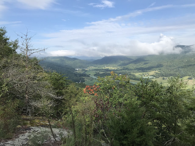
Chattahoochee National Forest. Near Toccoa, GA.

Adirondack Trip Summary

Image
Great summer trip to the Adirondacks (with a little side trip through NH and Vermont thrown in).  1001 miles driven, over 14 days.  66 miles of hiking plus quite a few more in kayaks and canoe. One of the highlights of the trip was a hike to the top of Goodnow Mtn., which has a fire tower on top.  Climbing to the top provides unforgettable views of the Adirondack High Peaks. Unfortunately, my sidekick got injured near the bottom and now Courtney is in convalescence mode.

Upper Hudson River Valley (East Branch)

Image
Adirondack High Peaks view near Upper Works. 10 miles from Newcomb, NY.  Mt. Colden (4714') and Mt. Marcy (5344') in distance.

West Branch Hudson River Flow

Image
Near Newcomb, NY. 4 hour paddle from rich Lake back to Cloudsplitters.