Posts

Lake Tahoe Trip Summary

Image
Winter paradise at Lake Tahoe.  We stayed in Incline Village, NV and spent time in CA and NV.  41 miles of hiking, snowshoeing and cross country skiing plus a half-day downhill at Mt. Rose/Slide Mtn.  Beautiful weather and we arrived two weeks after an epic 6' snowstorm! Even had a trip down to the edge of the Central Valley for a warm weather hike.
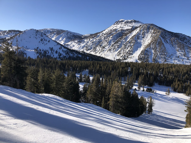
Slide Mountain Ski

Image
Downhill today at Mt Rose. Memories of the '80s on old Slide Mountain. Near Reno, NV. 

Freeway

Image
Best route on Diamond Peak for beauty vs effort. Incline Village, NV. 

Return to Chickadee Ridge...

Image
Toiyabe NF, near Incline Village, NV. 

Tunnel Creek

Image
Spooner Backcountry, Toiyabe NF. Near Incline Village, NV. 

Lake Tahoe

Image
From Diamond Peak. Incline Village, NV. 

Stateline Fire Lookout

Image
Near Crystal Bay, NV. 

Rose Knob Peak

Image
Snowshoe view from Diamond Peak. Incline Village, NV. 

Spooner Lake

Image
Snowshoe around the lake at Lake Tahoe Nevada State Park. Near Incline Village, NV.

Lake Overlook from Snowflake

Image
Snowshoe at Diamond Peak. Incline Village, NV.  Miles of groomed walking!

Chickadee Ridge

Image
Snowshoe heaven above Tahoe Meadows!  Toiyabe NF, near Incline Village, NV. 

Robie Point Firebreak Trail

Image
Auburn State Recreation Area. American River Canyon. Near Auburn, CA.

Lodgepole Trail

Image
Snowshoe at Diamond Peak Ski Area.  Uphill Use program is amazing! Incline Village, NV. 

Nevada Trip Summary

Image
Great winter visit to southern and central Nevada.  Weather was milder than normal.  It's a vast landscape with wide valleys and endless deserts.  In many places, hiking trails don't exist but cross-country travel is easy to navigate. 1263 miles driving and 60 miles of hiking over 9 days.  Spent nights in Beatty, Tonopah and Vegas. The desert changes constantly.  Here is a beautiful evening view from Tonopah looking south.

Mummy Mountain

Image
11533'. Spring Mountains National Recreation Area. Lower Bristlecone Trailhead. Near Las Vegas, NV. 

Rocky Ridge Trail

Image
Lee Canyon, in Spring Mountains National Recreation Area. Near Las Vegas, NV. 

Desert National Wildlife Refuge

Image
Approximately 2300 square miles to explore in Southern Nevada.  Near Las Vegas, NV.

Cold Creek Foothills

Image
Above Indian Springs, NV. Mild afternoon!

Cold Creek Canyon

Image
Spring Mountains National Recreation Area. Near Indian Springs, NV. 

Big Dune

Image
Amargosa Desert, near Amargosa Valley, NV. ~ 500' high sand dunes in valley center. 

Rhyolite Hills

Image
 Upper Amargosa Desert.  Near Beatty, NV.

Goldfield Hills

Image
 Montezuma Peak in the distant right.  Near Goldfield, NV.

Tonopah Point

Image
 Old US 95, south of Tonopah, NV.  Looking west towards California.

Columbus Salt Marsh

Image
Overlook towards Emigrant Peak. Near Coaldale, NV. 

Montgomery Pass

Image
Owens Valley and the Sierra Nevada mountains in the distance. Near Coaldale, NV. 

Monitor Point

Image
Monitor Valley. Table Mountain in the distance.  Near Tonopah, NV.  

Belmont Rocks

Image
Near Belmont, NV. Toquima Range in the distance.  Mt. Jefferson South Summit to right.

Ophir Snowshoe

Image
H-T NF. Near Carvers, NV. 

Ophir Canyon

Image
Toiyabe Range. Humboldt-Toiyabe NF. Near Carvers, NV. 

Desert Evening

Image
Walk near Tonopah Summit. Near Tonopah, NV.