Posts

Southern Colorado Trip Summary

Image
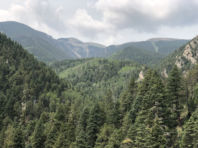
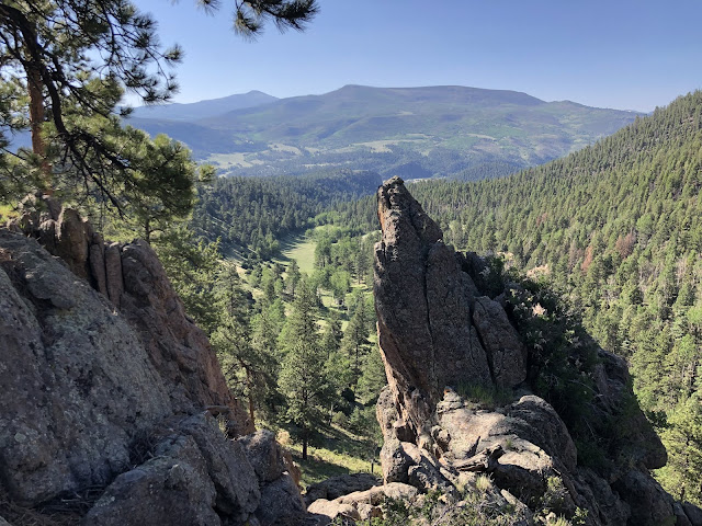
Beautiful summer visit to southern Colorado!  Oddly enough, I was headed for Wyoming but a predicted heat wave had me look for alternatives and southern Colorado was predicted to be 10-15 degrees cooler. 100 miles hiked and 1000 miles driven over 9 days.  I explored four different mountain ranges: Wet Mountains, Sangre de Cristo, San Juan Mountains and the Spanish Peaks.  Some wildfire smoke moved in the last two days of the trip, but overall the weather was sunny, dry, and pleasantly warm. View to the east looking down from Lobo Overlook.  Wolf Creek Pass, Rio Grande NF, near South Fork, CO.
Greenhorn Trail

Image
Greenhorn Mountain looms. San Isabel NF, near Rye, CO.

Cuchara Valley

Image
West Spanish Peak in the center. San Isabel, NF. Near Cuchara, CO. 

Wolf Creek Pass

Image
Hiking at Wolf Creek ski area. Near South Fork, CO. 

Big Meadows Reservoir

Image
South Fork of the Rio Grande River. Rio Grande NF, near South Fork, CO. 

Sentinel Peak Attempt

Image
Walker Draw got in the way! Rio Grande NF, near South Fork, CO.   
Continental Divide Trail - Wolf Creek Pass

Image
From Lobo Overlook. Near South Fork, CO. 

Morning in South Fork

Image

Trout Creek Trail

Image
Short drive from South Fork to trailhead. Rio Grande NF. Views of Sentinel Peak? 

Elephant Rocks

Image
Unique BLM area between La Garita and Del Norte.

Eagle Mountain Approach

Image
Have to save climb to top for another day. Rio Grande NF, near La Garita, CO.

South Colony Basin

Image
Crestone Needle and Humboldt peaks at center and right. Sangre de Cristo Wilderness, San Isabel NF, near Westcliffe, CO.

White Hills

Image
Mild evening. Just outside Westcliffe, CO. 

Rainbow Trail

Image
Fantastic shoulder trail in the Sangre de Cristos. Views across the valley to the Wet Mountains. From Horn Creek trailhead, San Isabel NF. Near Westcliffe, CO. 

Sangre de Cristo Wilderness

Image
Venable trail to lakes. San Isabel NF, near Westcliffe, CO.

Sangre de Cristo Vista

Image
View from Wet Mountains foothills, near Westcliffe, CO. 

Round Top Mountain

Image
About 10K'. View of St Charles Peak and Greenhorn Peaks in the distance. Wet Mountains, San Isabel NF, near Westcliffe, CO. 

Upstate Trip Summary

Image
 Nice, short trip "upstate" in Georgia, South Carolina and North Carolina, looking for hills and cool air!  About 900 miles of driving, 30 miles of hiking, a little kayak paddling and some mountain biking over 4 days.  Plus some very interesting history along the way.

Edisto River

Image
 From Edisto Memorial Gardens, in Orangeburg, SC.  Looks like a future paddling trip to me!

Blue Ridge Escarpment

Image
View from Caesar's Head State Park, near Cleveland, SC.  Table Rock Mtn is in the distance, with the lake at its base.

Big Rock Trail

Image
View of the Appalachian high country from the Dupont State Forest. Near Brevard, NC. 

Green River Game Lands

Image
North Carolina hunting area above the Big Hungry and Green Rivers. Near Hendersonville, NC.

Glassy Mountain

Image
Carl Sandburg home National Historic Site in Flat Rock, NC.

Ninety-Six

Image
Revolutionary War-era National Historic Site, near Greenwood, SC. The British employed a star-shaped fort to defend and withstand a siege from the Continental Army in 1781. 

Soap Creek

Image
Wildlife Management Area and tributary of Savannah River and Clarks Hill Reservoir.  Rain shower just ending. Near Lincolnton, GA.   

Clarks Hill Lake

Image
Kayaking at the Amity Recreation Area on the Georgia side. Lake is 70,000+ acres, ~ 50 miles long and 330' above sea level on the GA-SC state line. Built by US Army Corp of Engineers as flood control project on the Savannah River.

Boundary Waters Canoe Area Trip Summary

Image
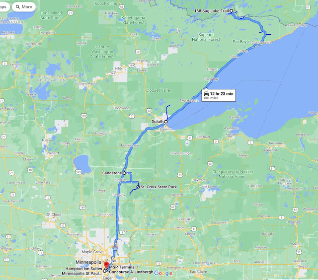
Beautiful spring trip and reunion in northern Minnesota with old friends David, Tom and Jim! 5 miles of canoe paddling, 54 miles of hiking, and 859 miles of driving over 8 days.  The weather was great after an early rough start with wind and bugs.  It cooled down and dried out and we had 5 straight days of beautiful weather and minimal bugs.  Between the Boundary Waters, Lake Superior and the MN rivers, this was definitely a water trip!

Two Rivers

Image
Where the Kettle River joins the St. Croix, on the MN-WI border. Near Hinckley, MN.

Kettle River

Image
Known for good rafting, the Kettle River flows south into the St. Croix River.  2nd photo is from bridge the following morning. Near Sandstone, MN.

Superior North Shore

Image
Travel day with stops along the way. George Washington pines, Grand Marais overlook, Caribou River falls, Silver Creek cliffs and the Duluth waterfront were all nice. View below is Lake Superior overlook of Grand Marais, MN.