Posts

Nevada and California Trip Summary

Image
Great fall trip to Reno, NV and the nearby California Sierras.  Weather was 10-15 degrees colder than normal, including early snow! 542 miles driven and 40 miles of hiking and snowshoe over 7 days, plus visit with daughter and her fiance.

East Keystone

Image
Travel day!  Reno, NV. 

Ditch Trail

Image
Reno, NV.  Near Hunter Creek TH. 

Eureka Lake

Image
Snowshoe in Plumas State Park. Near Portola, CA. 

East Keystone

Image
Sunset over the Sierras. Reno, NV. 

Huffaker Hills

Image
Reno, NV. 

Lower Clark Mountain

Image
West approach. Near Lockwood, NV. 

California Trail

Image
Humboldt-Toiyabe NF. Near Verdi, CA. 

Chickadee Ridge

Image
Above Lake Tahoe.  Tahoe Meadows Recreation Area. Near Incline Village, NV. 

Reno Twilight

Image
West Keystone TH. Reno, NV. 

Plumas Snowshoe

Image
Eagle Lake Road, Plumas-Eureka State Park. Near Portola, CA. 

West Keystone

Image
After snowstorm. Reno, NV. 

East Keystone

Image
Reno, NV. 

Long Beach

Image
Long layover in Long Beach, CA. Small airport allows for a walkabout! And rain meant a deserted golf course. 

Glassy Mountain

Image
Near Pickens, SC.

Big Rock Mtn

Image
Overlook from Big Rock Mountain. Nine Times Forest, near Pickens, SC. 

Nine Times Forest

Image
Near Pickens, SC. 

Table Rock Mountain

Image
Table Rock State Park. Near Pumpkintown, SC. 

Twin Falls

Image
Near Sunset, SC. 

Nine Times Preserve

Image
View towards Pickens and Glassy Mountain. Near Pickens, SC. 

Nine Times Preserve

Image
Cedar Rock Mountain trail.  View of Glassy Mountain.  Near Pickens, SC.

Black Balsam Knob

Image
Top of the Blue Ridge Mountains at 6214'!  View to the south to the piedmont and beyond.  Pisgah NF, near Brevard, NC.

John Rock

Image
View of Looking Glass Mtn from John Rock. Pisgah NF. Near Brevard, NC. 

Colorado High Country Trip Summary

Image
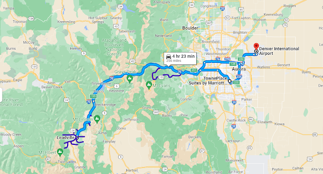
Great, late summer trip to Leadville, CO, for a reunion with high school buddies Tom, Jim and Dave.  700 miles driven and 86 miles hiked over 10 days.  We had a little rain, but it didn't slow us down much.  Temps were in the 60s during the day and 30s overnight, so it was very pleasant!  The aspens were just beginning to turn, which was a nice bonus!

Chief Mountain

Image
360 degree views!  View of Mt Evans looking west. 

Clinton Reservoir and Gold Hill

Image
White River NF. Near Fremont Pass, CO.

Arkansas River Headwaters

Image
Mt Arkansas in center. San Isabel NF. Near Fremont Pass, CO. 

Bald Eagle Mountain

Image
Colorado Trail. Mt Massive Wilderness Area, San Isabel NF. Near Leadville, CO. 

Empire Hill

Image
Little Union Gulch. San Isabel NF, near Leadville, CO. Views west to Sawatch Range and Mts Elbert and Massive.   

Mt Massive Meadow

Image
View of Upper Arkansas River Valley and Leadville to the East. Mt Massive Wilderness Area, San Isabel NF. Near Leadville, CO.