Posts

California Nevada Trip Summary
Image
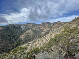
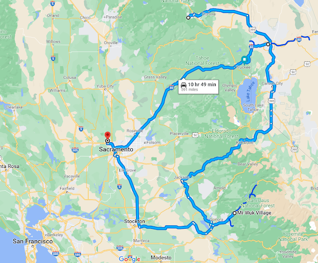
Great winter trip to California and Nevada to hike, snowshoe and visit our daughter.  Started out on the West slope of the Sierra Nevada mountains and finished the trip on the East slope.  The Stanislaus River valley had seen 35' of snow before we arrived and they've had another 20' since we left, and it's still snowing! 1262 miles driven and 91 miles of snowshoe and hiking.  Snow boots were a necessity! Looking east to Sonora Pass in the Stanislaus River watershed.  Second photo is New Melones reservoir, which is filling up fast!

Plumas-Eureka State Park

Image
 Snowshoe day!  Near Graeagle, CA.

East Keystone

Image
 New snow!  East Keystone trailhead, Reno, NV.

Painted Rock

Image
Near Fernley, NV. 

East Keystone

Image
Peavine Mountain. Storming in the Sierras! Near Reno, NV. 

Golden Eagle Canyon

Image
Pah Rah Mountains. Regional Park near Reno, NV. 

Hunter Creek

Image
Tahoe NF, near Reno, NV. 

California Trail

Image
Toiyabe NF. Near Verdi, CA. 

Bald Mtn Reprise

Image
Stanislaus NF. Dodge Ridge pano. Near Cold Springs, CA. 

Upper Bald Ridge

Image
Stanislaus NF, near Cold Springs, CA. 

Long Barn Ridge

Image
Stanislaus NF, near Long Barn, CA. 

Dodge Ridge

Image
Snowshoe from Crabtree Trailhead. Down Ridge Trail. Stanislaus NF, near Pinecrest, CA. 

Punch Bowl

Image
Bull Run Creek valley. Stanislaus NF.  Near Strawberry, CA.

Stanislaus Ridge

Image
Stanislaus NF. Near Dodge Ridge, CA. 

Strawberry Peak

Image
Snowshoe day! View up the South Fork Stanislaus River valley. Stanislaus NF, near Strawberry, CA.  

Long Barn

Image
Stanislaus NF, near Long Barn, CA. 

North Fork Tuolomne River

Image
Westside trail. Near Tuolomne, CA. 

Pinecrest Lake

Image
Stanislaus NF, near Pinecrest, CA. 

Crabtree Winter Trails

Image
Stanislaus NF, near Dodge Ridge and Pinecrest, CA. 

Lyons Point

Image
Stanislaus Valley overlook. Near Sierra Village, CA. 

Bald Mountain

Image
Snowshoe hike on a mild February day. Stanislaus NF, off Hwy 108 near Cold Springs, CA. 

Southeast Arizona Trip Summary

Image
Sun-drenched visit to Southeast Arizona was very enjoyable.  832 miles driven and 78 miles hiked over eight days.  The highlight was visiting so many mountains ranges - what they call "Islands in the Sky".  These pop up out of the desert and each one is different and as you go up in elevation the flora changes from desert to forest.  The ranges that I visited were: Tucson Mountains Santa Rita Mountains Santa Catalina Mountains Rincon Mountains Whetstone Mountains Dragoon Mountains Pinaleno Mountains Gila Mountains Black Hills San Francisco Mountains Greasewood Mountains Chiricahua Mountains Sunrise and sunset are also spectacular in Arizona when there's a little cloud cover.  This was sunset near Madera Canyon in the Santa Rita Mountains. My next visit I intend to explore some more segments of the Arizona Trail.  Out of the 800 miles of the trail, I've only hiked about 4 so far!

Sugarloaf View

Image
View of Chiricahua Mountains with National Monument in foreground. Near Willcox, AZ. 

Chiricahua Rocks

Image
Chiricahua National Monument. Echo Canyon Loop. Near Willcox, AZ. 

Greasewood Hills

Image
Near Safford, AZ. 

Painted Bluffs

Image
Apache NF, near Clifton AZ.  

Pinal Point

Image
Apache-Sitgreaves NF, near Clifton, AZ.

Guthrie Peak

Image
Black Hills Scenic Byway. Between Safford and Clifton, AZ. 

Gila Mountains

Image
Desert walk near Safford, AZ. 

Ladybug Trail

Image
From bottom, at Angle Orchard, to Veach Ridge.  Coronado NF, near Safford, AZ.