Posts

Southeast Loop Trip to the Blue Ridge Mountains

Image
Nice driving trip in the Fall colors of Georgia, South Carolina and North Carolina. 880 miles driven and  40 miles of hiking over five days. Beautiful view over the southern foothills and piedmont from the top of the Blue Ridge at Black Balsam Knob at 6200'. Looking Glass Mtn. in the morning light.

Parson’s Mtn

Image
Sumter NF, near Abbeville, SC. 

Big Rock Trail

Image
DuPont State Forest. Near Cedar Mountain, NC.

Sam Knob

Image
Pigeon River watershed.  Pisgah NF. Near Brevard, NC. 

Coontree Loop

Image
To Bennett Gap. Pisgah NF, near Brevard, NC.

Cat Gap Loop

Image
Featuring John Rock and Looking Glass Mtn. Pisgah NF, near Brevard, NC. 

Black Balsam Knob

Image
From Blue Ridge Parkway. Pisgah NF, near Brevard, NC. 

Early Blue Ridge Snow

Image
Hiking on Mountain to Sea trail at Devil's Courthouse. Pisgah NF, near Brevard, NC. 

Bracken Preserve

Image
Hiking above Music Center in Brevard, NC. 

Altamaha River

Image
Sansavilla WMA. Near Mt. Pleasant, GA. Wayne County.

Southern Colorado Trip Summary

Image
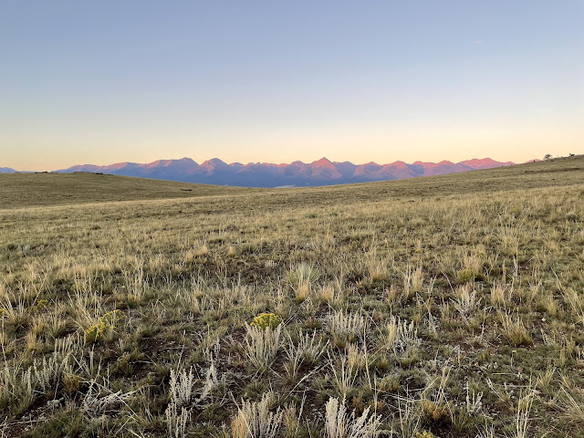
Great friends reunion summer trip to Southern Colorado in the Wet Mountain Valley! 97 miles of hiking, 962 miles driven, plus some ATV, UTV and Jeep trail riding!  Great time with Tom, Jim and David out of our base in Westcliffe, CO. Occasional weather gave us beautiful clouds and light!  Westcliffe is a nice, small, rural town surrounded by beautiful cattle country!

Beck Mtn

Image
From Grape Creek TH via Rainbow Trail and some bushwhack. Overlooks Music Creek valley with Milwaukee Peak in center and Marble Mtn to right, and Music Mtn to left. San Isabel NF, near Westcliffe, CO. 

Comanche Peak

Image
From the Comanche/Venable Rainbow trail loop. San Isabel NF, near Westcliffe, CO. 

Bear Peak

Image
BLM land near Westcliffe, CO. 

Sangre de Cristo Sunrise

Image
Namesake colors from the White Hills. Near Westcliffe, CO.

Bull Domingo High Point

Image
BLM land near Westcliffe, CO. 

Conquistador

Image
Hiking runs from abandoned ski area. Via Rainbow Trail from Venable TH. San Isabel, NF. Near Westcliffe, CO.   

Williams Point

Image
Off 402/634 in Greenhorn area. San Isabel NF. Near Gardner, CO. 

Wylie Gulch

Image
San Isabel NF, near Gardner, CO. 

Horn Peak Trail

Image
Sangre de Cristo Wilderness Area. San Isabel NF, near Westcliffe, CO.

Peel Point

Image
Continental Divide trail from Monarch Pass. Near Salida, CO. 

Cristo Vista

Image
Sangre de Cristo Mountains from Deer Peak, Wet Mountains. San Isabel NF, near Westcliffe, CO. 

Hermit Lake

Image
Via Jeep trail on Hermit Rd. San Isabel NF, near Westcliffe, CO. 

Lakes of the Clouds

Image
Via Swift Creek trail. Sangre de Cristo Wilderness Area, San Isabel NF. Near Westcliffe, CO. 

White Hills

Image
Mild evening above Westcliffe, CO. Sangre de Cristo mountains and San Isabel NF to the west. 

California - Nevada Early Summer Trip

Image
Beautiful trip around and through the Sierra Nevada mountains in early summer.  Lots of snow at the higher elevations and the creeks and rivers were raging!  The Central Valley was in full growing mode with all the water available. 1877 miles driven and 130 miles hiked over 16 days, 10 miles or so on snowshoes!  Plus a wedding shower for my daughter in Reno! Return visit to Golden Trout Wilderness via Horseshoe Meadow.  Road had just opened in mid-June.

Meysan Lakes Trail

Image
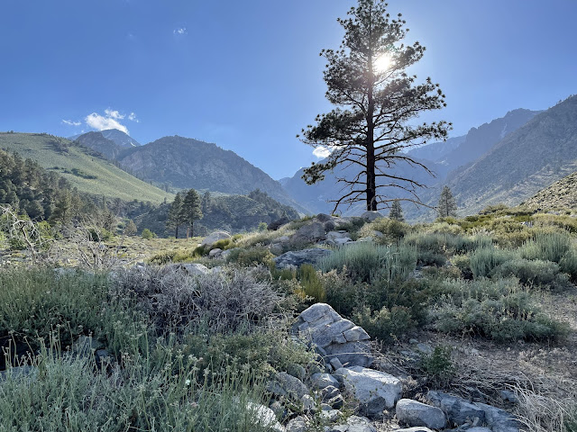
John Muir Wilderness, Inyo NF. Near Lone Pine, CA. 

Golden Trout Wilderness

Image
Cottonwood Creek. Inyo NF, near Lone Pine, CA. 

Owens Valley Evening

Image
Near Independence, CA. 

Baxter Pass

Image
John Muir Wilderness, Inyo NF. Near Independence, CA.