Posts

Penholoway Swamp

Image
 Wildlife management area near Gardi, GA.  Both hiking and kayaking options!

Southeast Arizona Trip Summary

Image
Nice, end of Fall trip to the desert Southwest.  This area is an "archipelago" of sky islands of mountains that rise up out of the desert floor, and I enjoyed visiting the Rincon, Dragoon, Chiricahua, Pinaleno, Dos Cabezas, and Tucson mountain ranges during my visit.  Not a drop of rain and temperatures were 40-70 degrees! 720 miles driven and 67 miles hiked over 8 days.  View below is in the Pinaleno range, in the Coronado NF, near Safford, AZ.

Arizona Trail

Image
Coronado NF. Near Rosemount OHV area. 

Rincon East

Image
Saguaro NP. From Miller TH. Near Tucson, AZ. 

Lower Chiricahua

Image
Natural Bridge trail. Chiricahua NM. Near Willcox, AZ. 

Fort Bowie

Image
National Historic Site. US Army.  Near Bowie, AZ. 

Marijilda Pass

Image
Coronado NF, near Safford, AZ. 

Round the Mountain Trail

Image
Pinalenos Mtns, Coronado NF. Near Safford. AZ. Started at Noon Creek CG. 

Ladybug Peak

Image
Pinaleno Mtns, Coronado NF. Near Safford, AZ. View south to Dos Cabezas and Chiricahuas. 

Monte Vista

Image
Chiricahua Wilderness, Coronado NF. Via Morse Canyon trail #43. Peak is 9370'. In the vicinity of Willcox, AZ. 

Dos Cabezas Flank

Image
Coronado NF, near Willcox, AZ. 

Stronghold Divide

Image
Cochise trail, from East Stronghold. Coronado NF, near Willcox, AZ. 

Rincon Mountains

Image
Saguaro NP East. Loma Alta TH. Near Tucson, AZ. 

Seaton Creek Historic Preserve

Image
 Final wedding departures provided the opportunity!  Pecan Park Rd. exit off I-95.  Near JAX airport.

Southeast Loop Trip to the Blue Ridge Mountains

Image
Nice driving trip in the Fall colors of Georgia, South Carolina and North Carolina. 880 miles driven and  40 miles of hiking over five days. Beautiful view over the southern foothills and piedmont from the top of the Blue Ridge at Black Balsam Knob at 6200'. Looking Glass Mtn. in the morning light.

Parson’s Mtn

Image
Sumter NF, near Abbeville, SC. 

Big Rock Trail

Image
DuPont State Forest. Near Cedar Mountain, NC.

Sam Knob

Image
Pigeon River watershed.  Pisgah NF. Near Brevard, NC. 

Coontree Loop

Image
To Bennett Gap. Pisgah NF, near Brevard, NC.

Cat Gap Loop

Image
Featuring John Rock and Looking Glass Mtn. Pisgah NF, near Brevard, NC. 

Black Balsam Knob

Image
From Blue Ridge Parkway. Pisgah NF, near Brevard, NC. 

Early Blue Ridge Snow

Image
Hiking on Mountain to Sea trail at Devil's Courthouse. Pisgah NF, near Brevard, NC. 

Bracken Preserve

Image
Hiking above Music Center in Brevard, NC. 

Altamaha River

Image
Sansavilla WMA. Near Mt. Pleasant, GA. Wayne County.

Southern Colorado Trip Summary

Image
Great friends reunion summer trip to Southern Colorado in the Wet Mountain Valley! 97 miles of hiking, 962 miles driven, plus some ATV, UTV and Jeep trail riding!  Great time with Tom, Jim and David out of our base in Westcliffe, CO. Occasional weather gave us beautiful clouds and light!  Westcliffe is a nice, small, rural town surrounded by beautiful cattle country!

Beck Mtn

Image
From Grape Creek TH via Rainbow Trail and some bushwhack. Overlooks Music Creek valley with Milwaukee Peak in center and Marble Mtn to right, and Music Mtn to left. San Isabel NF, near Westcliffe, CO. 

Comanche Peak

Image
From the Comanche/Venable Rainbow trail loop. San Isabel NF, near Westcliffe, CO. 

Bear Peak

Image
BLM land near Westcliffe, CO. 

Sangre de Cristo Sunrise

Image
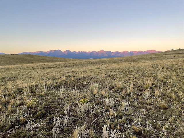
Namesake colors from the White Hills. Near Westcliffe, CO.

Bull Domingo High Point

Image
BLM land near Westcliffe, CO.