Posts

Rancho San Rafael

Image
Regional park in Reno, NV.  Evening view of the Sierras. 

Wolf Run

Image
Mountain golf, near Reno, NV. 

Lake Park

Image
Beautiful Fall evening in Reno, NV. 

Parsons Mountain Lookout

Image
View to the north. Sumter National Forest, near Abbeville, SC. 

Sunset on the Foothills

Image
From Glassy Mountain, near Pickens, SC. 

Devil’s Courthouse

Image
Off Blue Ridge Parkway, near Brevard, NC. 

Sam Knob

Image
Pisgah National Forest, off Blue Ridge Parkway. Near Brevard, NC. 

Fryingpan Lookout

Image
Fryingpan Mtn trail. Off Blue Ridge Parkway near Brevard, NC.

Pisgah Summit

Image
Mt Pisgah trail from Blue Ridge Parkway. Pisgah National Forest near Brevard, NC.  And a view of Pisgah from the trailhead.

Swamp Rabbit Trail

Image
Ride in Greenville, SC.  Reedy River Falls. 

Caesar’s Head Overlook

Image
Near NC/SC state line, above Cleveland, SC. 

Big Rock Trail

Image
DuPont State Forest, near Cedar Mountain, NC. 

Big Glassy Mountain

Image
Carl Sandburg National Historic Site, Flat Rock, NC. 

Broad River

Image
Kayak trip down the Broad after a nice rain. Running strong, near Rutherfordton, NC. 

Thermal Belt Trail

Image
Evening ride on the trail in Rutherfordton, NC.

Colorado Trip Summary

Image
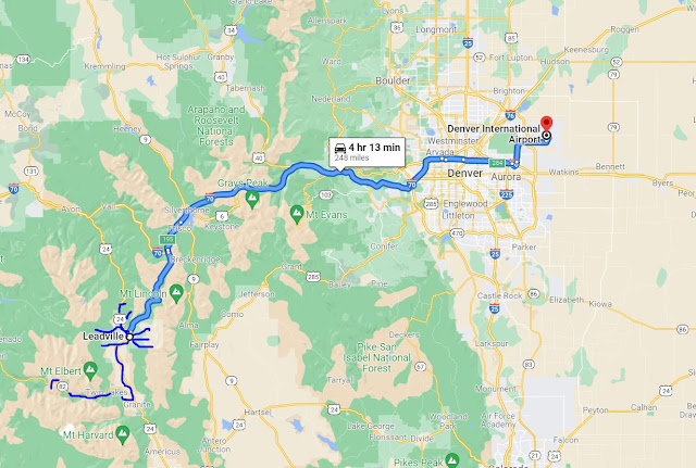
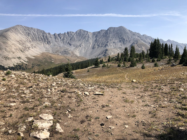
Great late summer trip to the Leadville, CO area.  Weather was sunny and mild.  500 miles driven and 77 miles of hiking over 7 days.  After leaving I-70 and driving over Fremont Pass (11,318'), you descend into the Arkansas River Valley where I spent almost the whole trip.  The bottom picture is the Upper Arkansas River.  It flows 1469 miles (6th longest in US) until it joins the Mississippi in southeast Arkansas.

Dyer Ponds

Image
Between East and West Dyer Peaks. Near Leadville, CO. 

Little Ellen Hill

Image
Returned to this hike to get to the top! Near Leadville, CO.

Independence Pass

Image
12,000' highway pass with hikes in both directions. East side view of Lackawanna Gulch and Casco Peak, with Mt Elbert behind.  West side view of Ouray Peak. 

Little Ellen Hill

Image
Above Leadville, CO. 

Mount Zion

Image
12126'. Buckeye Peak in the distance and Chicago Ridge further beyond.  San Isabel NF. Near Leadville, CO.

Fish Hatchery

Image
An old favorite, it was a sublime evening. Leadville National Fish Hatchery, near Leadville, CO. 

Prospect Mountain

Image
Prospect Mountain climb from Evans Gulch. View to north of Upper Arkansas River valley toward Fremont Pass. Near Leadville, CO.

Ball Mountain

Image
View towards Prospect Mountain and Mosquito Pass. Near Leadville, CO. 

Cooper Hill

Image
Skis area near Leadville, CO. Thought I could make it to Chicago Ridge, but no way! Mount of the Holy Cross in the distance in 2nd picture.

Mt Massive

Image
From Native Lake trailhead. Mt Massive Wilderness, San Isabel NF, near Leadville, CO. 

Clinton Gulch

Image
Shoulder hike between Clinton and Mayflower Gulches.  White River NF.  Near Leadville, CO. 

Straggler’s Point

Image
Looking east toward Coosa River valley and Cheaha Mountain. Near Cook Springs, AL. 

North Carolina Trip Summary

Image
We headed north in search of some cool air and found it in the Appalachian foothills and mountains of North Carolina!  Daily highs were low 70s in the mountains to low 80s in the foothills.  About 1000 miles driven, 30 miles of biking, ~ 15 miles of kayaking, and another 5 of hiking! View of Grandfather Mountain from Flat Top carriage trail at Cone Manor.

Broad River Kayak

Image
Near Rutherfordton, NC.